I'll admit it: I fell for it. Not because I thought I could plan my shoots with it, but because it just sounded cool. A watch that predicts low and high tide! How practical for someone who regularly photographs in El Cotillo and needs to know exactly whether the lagoon pool between the lava rocks is filled with water or if the sea has swallowed everything. But then, looking at this little display, a question popped into my head that I should have asked myself long ago as a photographer: I actually have no idea how this really works.
Sure, I've been planning my shoots with proper tide tables for a long time. Even when the model doesn't go into the water, I still need to know whether the water is coming or going and what it will look like on location. Sometimes the sand seems completely missing because the water level is higher. But why exactly? I must have missed that episode of "The Mouse Show".
The Beach That Wasn't There
The lesson that tides aren't just theoretical play came the hard way. On one of my Fuerteventura trips, I drove all the way south to La Pared. Almost two hours by car, the model in tow, the images of the wide sandy beach already in my head. That endless, golden sand against dramatic cliffs. Perfect.
When we arrived, there was no beach. Just cliffs and water crashing directly against the rocks. The damn high tide — I hadn't factored that in. We stood there, looking at the sea and then at each other. Almost four hours of driving there and back, for nothing.
The Science Behind the Water
So I did some research. After two hours down the rabbit hole of tidal research, I found out: Tides are significantly more complicated than my little Casio suggests. While tides are mainly caused by the moon and sun, a simple moon phase display is about as precise as throwing darts in a force-eight gale.
The moon's gravitational force doesn't just vary with its phases, but also with its distance from Earth. Sometimes it's as close as 356,000 kilometers, sometimes as far as 407,000 kilometers. That makes a huge difference. Add to that the sun with its own gravitational choreography, and both orbit in elliptical paths that are logically constantly changing.
In Fuerteventura, it gets even more complicated. The island may be in the open Atlantic, but the proximity to the African coast, the underwater topography of the Canaries, and even the trade winds influence how the tidal waves spread. The difference between high and low tide varies between 1.5 and 3.5 meters — depending on whether it's neap or spring tide.
For official tide tables, coastal stations have been continuously measuring water levels for over a century. This data is broken down through harmonic analysis into over 60 different periodic oscillations, each with its own amplitude and phase. The result: predictions accurate to within a few centimeters and minutes.
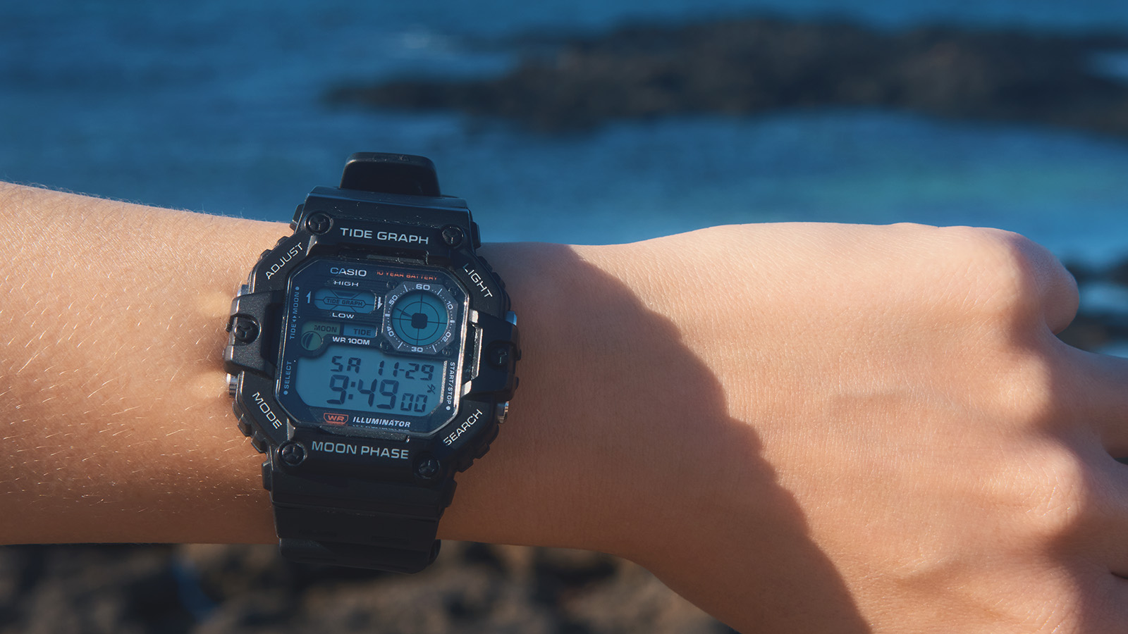
My 39-euro watch, on the other hand? It only considers the moon phase.
The Moral of the Story
Since then I know: When I'm standing in El Cotillo next time, wondering whether the water will be higher or lower in an hour, I look at my watch. But when I need it more precisely, there's no way around tide tables.
Secret agents probably don't wear 39-euro watches either.